
Transportation Plan
Richmond Parkway Transportation Plan
The Richmond Parkway Transportation Plan is now available for viewing. The Plan recommends priority strategies to equitably address key transportation challenges along the corridor, including safety, access, public health, and maintenance.
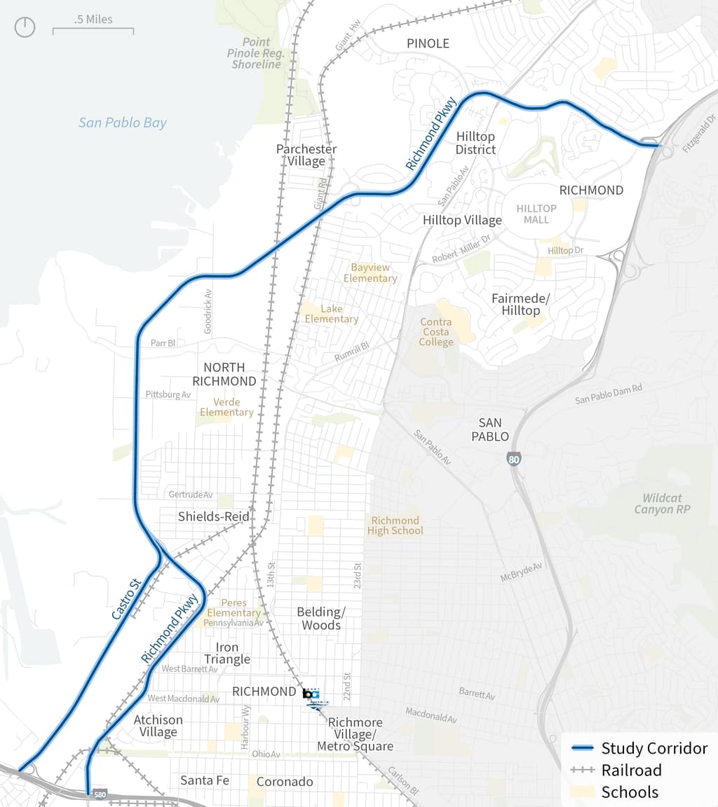
Study Area
Located in the City of Richmond and in unincorporated Contra Costa County, including North Richmond, Richmond Parkway is a major road linking I-80 and I-580. It serves many functions of regional and local importance, including goods movement, commuter traffic, the San Francisco Bay Trail, and a transit center.
Plan Overview
The Richmond Parkway Transportation Plan identifies strategies that equitably expand transportation options, support safe travel, and reduce public health impacts of truck and vehicle traffic along Richmond Parkway and Castro Street between I-80 and I-580. Given that many communities along the corridor have relatively high concentrations of low‑income people and people of color, a major component of this process consists of both in‑person and digital engagement with nearby community members.
Plan Documents
- Adopted Richmond Parkway Transportation Plan
- Appendix A: Engagement Summary Memos
- Appendix B: Overview of Regional Influence
- Appendix C: Plan Strategies Goals Alignment
- Appendix D: Richmond Parkway 35% Design Concept
- Appendix E: Existing Funding Sources for Priority Strategies
- Appendix F: Priority Strategy Cost Estimates
- Board Meeting Presentation #1
- Board Meeting Presentation #2
- Board Meeting Presentation #3
- Board Meeting Presentation #4
- Board Meeting Presentation #5
- Board Meeting Presentation #6